New Web Features are Released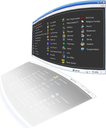
-
Switching between Domains
When managing big resource fleets of different zones and lines of service, switching between domain groups and subgroups is one click away. You can now manage big fleets easier. You can group company fleets under different divisions relative to their criteria, level of service, geographical zone, type, mission, management team or organizational division.
-
Enhanced Map Layer
A new map Layer has been added to enrich and enhace the map identification. The layer contains important points of interests such as banks, hospitals, ATMs, gas stations tourist sites and much more. This layer can be enabled or disabled optionally. By default, all map layers are included in our generated Reports.
New Clients & Partnerships
|
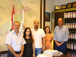
 Zahle Electricity Company went high tech with Smart Tracking. With our advanced GPS Software and map analysis tools, EDZ is now capable of exploring better ways to optimize their fleet performance when it comes to control, profitability, and the quality of service they provide to their clients. Zahle Electricity Company went high tech with Smart Tracking. With our advanced GPS Software and map analysis tools, EDZ is now capable of exploring better ways to optimize their fleet performance when it comes to control, profitability, and the quality of service they provide to their clients. |
 |
 Averda-Sukleen and Smart Tracking has just signed the contract. This exclusive contract will provide Sukleen the ability to use our advanced GPS monitoring and control center software over their fleet. Smart Tracking is capable of providing its partners with quality GPS Tracking & Fleet management System with high levels of precision, reliability, and with no GPS Data loss. Averda-Sukleen and Smart Tracking has just signed the contract. This exclusive contract will provide Sukleen the ability to use our advanced GPS monitoring and control center software over their fleet. Smart Tracking is capable of providing its partners with quality GPS Tracking & Fleet management System with high levels of precision, reliability, and with no GPS Data loss. |
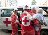 |
 Lebanese Red Cross, has versioned into the GPS technology with "dispatch & control" Incident Management system. Our enterprise management sytem will provide the Red Cross with full support, quality assurance & efficiency for better public assistance. Smart Tracking's high speed event management system is a full control center “look & feel” that stands on solid grounds in this domain. Lebanese Red Cross, has versioned into the GPS technology with "dispatch & control" Incident Management system. Our enterprise management sytem will provide the Red Cross with full support, quality assurance & efficiency for better public assistance. Smart Tracking's high speed event management system is a full control center “look & feel” that stands on solid grounds in this domain. |
|