Smart Tracking is a geographical information system (GIS) real time resource tracking and incident management system that serves the Middle East region and the world.
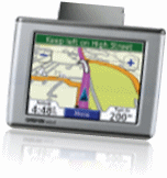
New GPS Device
Saves GPRS charges.
Customize the content of incoming data packets
Supports data compression.
Provides full routing and dispatching capability.
Full support for Garmin FMI version 2 interface.
Contains 8MB of storage (that lasts for weeks).
Commercially Priced.
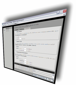
Remote Vehicle Configuration
over the web is now released Smart Tracking released a new feature in the web application which enables the user to configure the tracking device installed in a vehicle remotely. The available web command set includes:
: command will set the time interval at which the device sends its coordinates via the GPRS connection.
: command queries the location of the device to determine if the device is connected and alive to be able to receive additional commands.
: command defines the legal zones or geographic areas with which this vehicle is allowed to operate. The user picks any point from the map as the center of the circular geofence and assign the radius of the circle.
:command will set a maximum time the vehicle can remain stationary without GPS signal OR be stationary in a single spot.
:command will set the speed limit in the device. You can also set the speed interval (if exceeded the device will send an Over-speed violations).
: This command will define the high set point and low set point temperatures allowed for the optional installed temperature sensor.
 Smart Tracking released a new feature in the web application which enables the user to configure the tracking device installed in a vehicle remotely. The available web command set includes: